
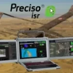
Preciso® ISR, an integrated AI-powered exploitation suite designed to enhance operational effectiveness across defence, homeland security, and civil protection missions.

Landslide identification and monitoring for infrastructure planning and management

Geoportal for e-Collaboration and dialogue between organizations and citizens in the planning process.

Fast acquisition of satellite imagery in emergency situations, designed for emergency service, Port Authorities, Public Administrations.

Geospatial Indexes for Territorial Planning and Strategic Environmental Assessment. Monitoring of soil loss.

Urban monitoring and automatic satellite-based detection of illegal constructions.

Cognitive Framework of marine and coastal areas and public defense works.

Cognitive Framework for Urban Planning and monitoring of Strategic Environmental Assessment (SEA).

Satellite orthoimages for the timely monitoring of changes on the territory.

Digital Elevation Models derived from Satellite for orographic studies and for the design and management of works and infrastructures

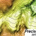
Geo-information products, derived from satellite data, designed to provide cognitive frameworks which meet the specific needs of each field of application.