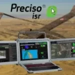
Automatic cloud-based geoinformation service for subsidence, landislide and ground motion monitoring and analysis over time.

Continuous monitoring of water and sewer pipeline stability

Automatic cloud-based geo-information service for the continuous monitoring of coastal seawater quality and marine resources.

Automatic cloud-based geoinformation service platform for territorial monitoring

Automatic cloud-based geoinformation service for subsidence, landislides and groud displacement monitoring and analysis over time

A hybrid space ecosystem for Earth Observation and Earth Intelligence that enables a new satellite as-a-service model to access on-demand in-orbit resources.

Kadmos is a suite of services that enables the combined and synergistic use of data from various missions

The software solution for satellite test, monitoring and control.

Image visualization and processing tool for EO and scientific data

Fast and robust satellite Attitude Determination Module

FPGA or SW solution for on-board hi-performance hyperspectral data compression and cloud classification

Geoportal for e-Collaboration and dialogue between organizations and citizens in the planning process.