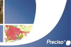
Geo-information products, derived from satellite data, designed to provide cognitive frameworks which meet the specific needs of each field of application.
Urban planning, environmental monitoring, controls and assessments of agricultural and forestry production, map updates, pre-and post-emergency management for civil protection, defense and security are the application areas that usually benefit from satellite data.
The Preciso® product family consists of geoinformation products, derived from satellite data, designed to provide cognitive frameworks that meet the specific needs of each application field.
The products of the Preciso® family are fully integrated with each other and can be combined to meet the most complex and diverse application and operational requirements. This feature makes them a flexible and modular solution.
The Preciso® family includes
Preciso® products are characterized by speed of production, high update frequency and low costs. They are ideal for the analysis of the territory and the activation of monitoring processes.
Preciso® products come from long and intensive research conducted within the framework of national and international projects, and have been tested in multiple operational projects.
All products are "Ready to use", do not require specific skills and can be used with common GIS software.
Contact our consultants
+39 0809644200
Technical support > Contacts >