The world’s most widely-used remote sensing software package for creating information from geospatial data.
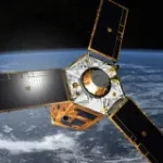
The largest Earth observation satellite constellation able to collect a picture of the Earth every day.
The two high resolution satellites Pléiades-1A and Pléiades-1B
Automatic cloud-based geoinformation service for subsidence, landislide and ground motion monitoring and analysis over time.
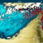
Automatic cloud-based geo-information service for the continuous monitoring of coastal seawater quality and marine resources.
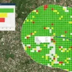
Automatic cloud-based geoinformation service platform for territorial monitoring
AI orchestration and intelligent resource management platform for secure, air-gapped and mission-critical environments.
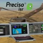
Preciso® ISR, an integrated AI-powered exploitation suite designed to enhance operational effectiveness across defence, homeland security, and civil protection missions.
Kadmos is a suite of services that enables the combined and synergistic use of data from various missions
(Decommissioned: archive imagery available) Very high-resolution satellite of the DigitalGlobe | MAXAR constellation
SecureWatch gives you instant access to the best of DigitalGlobe | Maxar technologies satellite imagery and geospatial data.
Fast acquisition of satellite imagery in emergency situations, designed for emergency service, Port Authorities, Public Administrations.