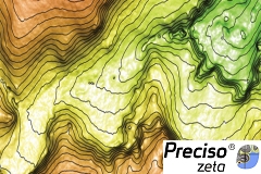
Digital Elevation Models derived from Satellite for orographic studies and for the design and management of works and infrastructures
An updated knowledge of the environment represents an important part in defining the design and the realization of works and engineering infrastructures. More specifically, the orography is a key element in the design process, starting from the preliminary phases and feasibility studies.
Updated information about orography, slope and exposure set up the bases for a modern design, aiming at reducing the impact over the environment, optimizing the investments, reduce maintenance and management duties.
The availability of this kind of information, updated and accurate, is not always guaranteed in areas hardly reachable. Operating in this area performing ground surveys or using aerial sensors can be costly and difficult to realize.
The use of digital elevation models extracted from satellite images represents the optimal solution for a fast data procurement in all the situations in which it is essential to have accurate data for studies and project quickly, also in remote areas. Thanks to the technological improvement and the availability of very high resolution satellite images, the characteristic of 3D info extracted from satellite stereo pairs are comparable to the ones obtained from traditional aerial surveys.
Preciso® Zeta is a geo-informational product, derived from satellite images acquired in stereoscopic mode, capable to give updated and detailed information about the orography of wide areas.
Preciso® Zeta includes:
Preciso® Zeta supports the preliminary and feasibility studies, the infrastructure monitoring and the study of the environment transformations.
Applications
Target
Benefits
DOWNLOAD
For further information, please write an email to sales @planetek.it
Preciso zeta (eng) by Planetek Italia
Technical Specifications
Preciso® Zeta is developed by processing high resolution satellite stereo images with advanced photogrammetric techniques.
It can be supplied over areas of the entire globe and with varying spatial resolutions, from 1 meter to 5 meters, to give the user the chance for the best product choice with respect to costs and needed accuracies. Preciso® Zeta is distributed in various file formats, each one compatible with the most popular GIS/CAD and design softwares.
Digital Elevation Model
Product type | Digital Elevation Model (raster format) and Contour Maps (vector format) |
Grid Resolution | 1 m / 2 m / 5 m |
Vertical Accuracy | ≤ 1 m (con σGCP ≤ 10 cm) |
Horizontal Accuracy | ≤ 4 m per almeno il 90% dei casi |
Satellite Orthorectified Coverage
Product type | Orthorectified mosaic in single file, with spatial resolution of 50 cm |
Horizontal Accuracy | ≤ 4 m for almost 90% cases |
Contact our consultants
+39 0809644200
Technical support > Contacts >