

The world’s most widely-used remote sensing software package for creating information from geospatial data.
ERDAS IMAGINE® the world’s leading geospatial data authoring system, incorporates geospatial image processing and analysis, remote sensing, and GIS capabilities into a single powerful, convenient package. ERDAS IMAGINE enables users to easily create value-added products such as 2D and 3D images, 3D flythrough movies, and cartographic-quality map compositions from geospatial data. Featuring a ribbon interface and custom workflow tabs so you can consolidate your favorite tools, ERDAS IMAGINE makes it easier to access what you need to work efficiently and productively. ERDAS IMAGINE also provides advanced tools for parallel batch processing, spatial modeling, map production, mosaicking, and change detection. In addition, ERDAS IMAGINE also incorporates the ERDAS ER Mapper algorithms and many GeoMedia utilities and implements OGC standards.
Available in three different product tiers, ERDAS IMAGINE is an ideal solution for a wide range of organizations and projects, enabling everyone to achieve superior results.
With a wide array of tools enabling you to analyze data from virtually any source and present it in formats ranging from printed maps to 3D models, ERDAS IMAGINE offers one comprehensive solution for all of your geographic imaging and image processing needs. It simplifies and streamlines your production workflow, saving you time, money, and resources without sacrificing accuracy.
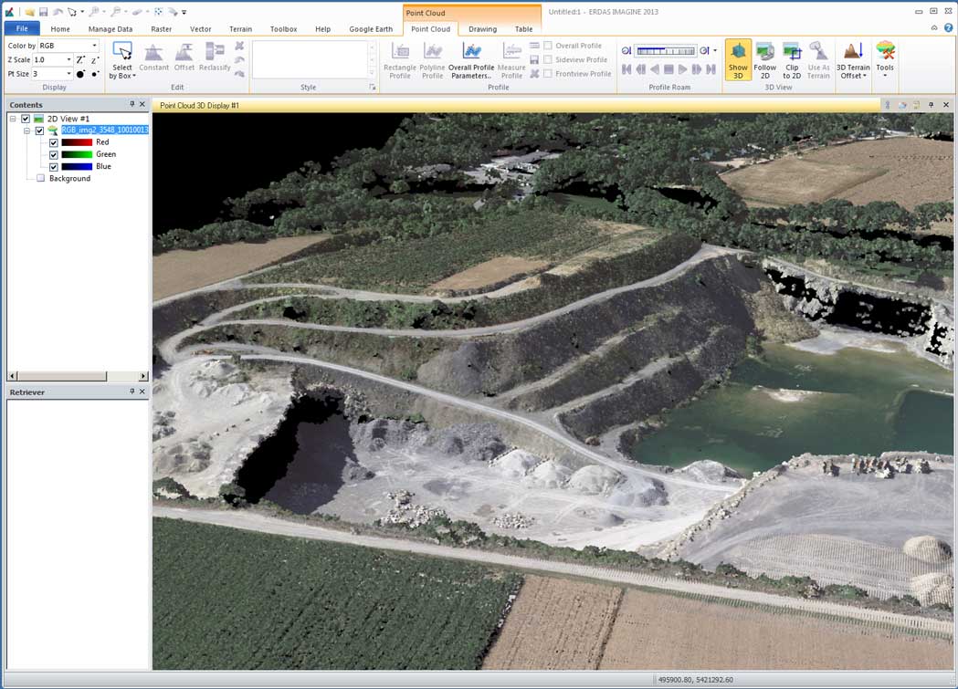
ERDAS IMAGINE fully enables the display, editing, and analysis of point clouds derived from LiDAR or generated from point correlation of stereo pairs. It also allows direct reading of LAS-formatted points clouds, enabling 2D/3D/profile viewing, symbolization, measurement, editing, and classification.
ERDAS IMAGINE is available in three different levels:
IMAGINE Essentials®:
A powerful, low-cost image and LiDAR mapping and visualization tool that allows different types of geospatial data to be combined and quickly organized for projects. IMAGINE Essentials provides a robust set of tools for geocorrection, analysis, visualization, and map output.
IMAGINE Advantage®:
A geographic imaging toolset that extends the capabilities of IMAGINE Essentials by adding more precise mapping and geospatial data processing functions.
IMAGINE Advantage includes a complete set of tools for analyzing imagery data via mosaicking, surface interpolation, radar analysis, advanced image interpretation, and orthorectification.
IMAGINE Professional®:
The most sophisticated geographic imaging software, IMAGINE Professional, includes complex hyperspectral image analysis and advanced classification tools. It also includes graphical spatial data modeling, a unique capability for analyzing spatial data.
The all-new spatial modeler is a dynamic, graphical spatial data modeling environment that provides real-time feedback and previews. The modern interface includes extended analysis operators and support for Python scripting. Authored models can be easily run in batch or published to a server (ERDAS APOLLO WPS). IMAGINE Professional includes an ERDAS ER Mapper license at no additional cost.
ERDAS IMAGINE ADD-ONS
Additionally, Hexagon® provides an array of add-ons that expand the core functionality of ERDAS IMAGINE so you can tailor it to your organization’s individual geospatial and business needs. These innovative products include the IMAGINE Expansion Pack, IMAGINE Photogrammetry, IMAGINE Objective, IMAGINE Terrain Editor, and many others.