The European Space Agency has launched the Global Development Assistance Programme inplemented in cooperation with International Financial Institutions.
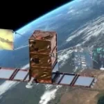
The COSMO-SkyMed Second Generation second satellite (CSG FM2) acquired the first images over the Pine Island glacier (Antarctica), the plateau near Pordenone (Italy), and the Galapagos islands (Ecuador).
The European Space Agency joined the DigitalXADB Virtual Tech Expo event, with the virtual booth: “European Space Agency: the experience of cloud processing of satellite data to support disaster ri
The Italian energy company will use satellite data to gather geoinformation for a wide range of activities, spanning from engineering, to environmental monitoring, and energy transi