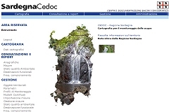
The latter evolution of Water Framework Directive related to the “characterization of shallow water” (Dir. 2000/60/EC) and the adoption of the shared information system, WISE, requested an update of the Sardinia Documentation Centre Database (CeDoc) that collects hydrographic basins data.
The Water Framework Directive asks the Member States a mandatory report compliant with the duties stated in the following articles:
- Art. 3 = identification of districts and of national cartography;
- Art.5 = analysis and characterization of the districts, list of protected areas;
- Art.8 = water bodies monitoring stations;
- Art.13 = districts characterization plan and water bodies classification reports.
Furthermore the directive requires the SOE/WFD (State of Environmental of Water Framework Directive) reporting about the environmental conditions. This reporting has to contain detailed data on the monitored water bodies.
The European Commission stated that SOE/WFD reporting must be an integral part of the new WISE system.
WISE “Water Information System for Europe”is a shared information system providing water related information available on European level. It stands for modernising and streamlining the collection and dissemination of information related to European water policy.
Technical Solution
Planetek Italia realized a new design and upgrade of the Sardinia Region’s CeDoc system in order to make the regional system be compliant with the European Directive 2000/60/CE and with the new WISE system requirements.
CeDoc is a web-based application for shallow and underground waters monitoring. It has specific functionalities for:
- supporting the monitoring activities,
- water bodies classification,
- publishing/reporting data according to the European Framework.
The database developed for the Sardegna CeDoc application is compliant with the Italian ISPRA SINANet (Italian Environmental Information System) model: the Subjects and Structures Objects Model (OSS).
The OSS model allows an optimised management of environmental data archive. In fact, the model is able to identify and to code both the territorial objects and the relations that join them.
Innovative Aspects
The system is based on a WebGIS interface for the cartographic consultation of territorial data.
CeDoc database organisation guarantees high performances and an intrinsic system compliant with environmental framework European evolution. Moreover this system allows an useful cooperation between municipal, provincial and regional institutions, by assuring the data exchange and the information accessibility through new technological channels. These operations work regardless to the platforms that each client uses to exploit.
A further important aspect of CeDoc is the full web-based application management, by using the Multi-Tier platform. This platform allows the achievement of several objectives:
- An improvement of monitoring data management system
- Fitting to the cooperation and to the distribution needs by assuring the system data security
- Simplification of environmental information inclusion, validation, extraction and reporting activities
Project information
Client information:
Regione Autonoma della Sardegna - Dir. Gen. Distretto Idrografico
Application fields:

