
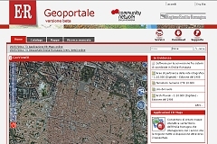
The GeoPortal of Emilia-Romagna Region is the reference access point for the regional territorial information and geolocalized knowledge, compliant to current interoperability directives: national (CNIPA, Intesa GIS) and international (INSPIRE, OGC).
The Emilia-Romagna Region set up a web channel to publish and give access to all the territorial information owned and produced by its Directorates and Agencies.
The Geoportal, which is available at http://geoportale.regione.emilia-romagna.it, represents the reference point and hub of "geo-localized" knowledge in support of regional and institutional activities of local governments that operate at the regional level of the individual citizen.
The goal Planetek Italia is carrying out in collaboration with the "Service development of digital and geographic information systems " of the Emilia- Romagna is to ensure the dissemination , use and distribution of data, information and services is a geographical to the public that the staff of the local public administration and / or national . In the implementation we have complied with the more recent directives regional, national (CNIPA, Intesa GIS) and international (INSPIRE, OGC) in terms of interoperability.
The technology used
The Geoportal of the Emilia-Romagna is made from Planetek Italia, powered entirely Open Source (Plone, OpenLayers, Ratman) and exposes web services that are OGC and ISO standards natively such as "Web Map Service" (WMS), "Web Feature service" (WFS), "Web Coverage service" (WCS), "Web Processing service" (WPS) and manages services data catalog "catalog Service - Web" (CS-W) available to external clients automatically.
The decision to base the geospatial data publication system on open standards, the Open Geospatial Consortium (OGC) and International Standardization Organization (ISO), means that the regional administration can count on an interoperable platform for sharing their data both internally and with third parties, and this makes the system compliant to INSPIRE Directive requirements.
Inside GeoER are available the following services:
- research services, allowing research of spatial data sets and related services, based on the content of the corresponding metadata and to display the content of metadata;
- consultation services, allowing at least the execution of the following operations: display, navigate, view scale (zoom in and zoom out), change in the portion of land framed (pan), or overlay viewable spatial data sets and visualization information contained in the legends, and any relevant content of metadata;
- services for downloading data, allowing the download of copies of data set, or a part of them, and access them directly;
- conversion services, allowing to transform spatial data sets in order to achieve interoperability;
- services allowing spatial data services invoke.
Front-End
GeoER allows the consultation to external web users (anonymous or authenticated on FedERa, the Federate authentication system of Emilia- Romagna bodies) and internal users (authenticated into the system of Identity & Access Management, IAM) .
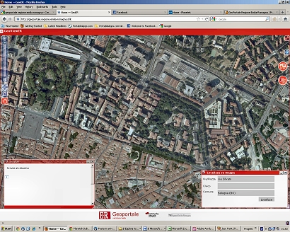
GeoER therefore provides direct access services to regional mapping exists in the database, provides access to raster and vector maps available and offers a set of functions to support that improve the usability for the user, such as:
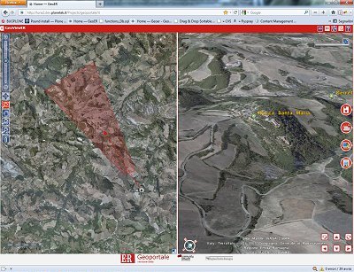
- 2D and 3D modes maps navigation,
- integration with the system for the management of urban decay,
- integration with the sales system Map & Bookshop,
- integration with the CMS -GIS Moka to access applications or allow existing cartographic depth analysis,
- data download,
- metadata consultation, through alphanumeric and geographic positioning research,
- the consultation of the data legend themed,
- querying alphanumeric information related to the features,
- the identify of a feature mapping using the search function and spatial queries.
GeoER has already been successfully submitted to a series of usability tests conducted by numerous users.
The intention was to be able to grasp as soon as the need for improvement of the functionality provided by GeoER. Thanks to usability testing and taking into account user feedback, a number of enhancements have been introduced to the user interface which led to the current version.
The Geoportal of Emilia Romagna was officially presented during the event CN-ER Burò on September 23rd, 2011 in Ferrara.
Read the article on the BLOG that talks about the Geoportal and this experience.
Watch all the video presentations of the Geoportal
- Geoportal presentation (7'21'' watch on youtube )
Discover the GeoViewER
- Phase 1 - Basic navigation tools (2'56'' watch on youtube)
- Phase 2 - Carthographic layers management (6'36'' watch on youtube)
- Phase 3 - Measurement, printing and scale tools (3'42'' watch on youtube)
- Phase 4 - Analysis and comparison tools (4'44'' watch on youtube)
- Phase 5 - Access to metadati (2'05'' watch on youtube)
- GeoViewER the complete video (15'46'' watch on youtube)