Geospatial Indexes for Territorial Planning and Strategic Environmental Assessment. Monitoring of soil loss.
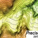
Digital Elevation Models derived from Satellite for orographic studies and for the design and management of works and infrastructures