
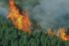
DSS for forest fires
VAMPIRE represent the implementation of a configuration of the downstream segment of future EO missions exploitation.
The VAMPIRE objective will be to configure the data provided from several EO mission, as well as the packaging and delivery in a way that this data can be used as valuable information to real world user.
The main objective is to enhance an existing system for Decision Support for fire emergency management, integrating satellite data in order to obtain information about forested areas and a model for the forest fire risk assessment.
In the project it has been defined and developed a prototype product for a customer of Planetek Italia, an environment management Agency: The Regional Forestry Authority of Puglia.
The pre-operative service
 After the system development phase, a pre-operative service has been implemented during the fire period in order to test the service. In this phase, the Vampire Service has been integrated in the operative procedures, for fire prevention and management already used from Regione Puglia. During the test period (during the summer 1999, from the 1st of July to end of September), Regione Puglia has used the Vampire service together with existing procedures in order to have a direct comparison.
During this phase the following thematic maps from remote sensing data and metereological data have been realised:
- Forest Map;
- Hot Spots map (1 each three days);
- Fire risk map (daily);
- Burned area map.

Metereological data used in order to generate maps are:
T = temperature measured at 12.00, in ° C
Tr = temperature of dew point measured at 12.00, in %
V = wind velocity measured at 12.00, in km/h)
P = rain collected for 24 hours until 9.00, in mm.
Earth Observation Data
VAMPIRE service products were derived from EO data, or from EO data integrated with other ancillary data available in the Vampire system:
- A local Forest Map, containing relevant soil uses classes and detailed forest classes was the first product created from a Landsat TM image base. Such map can be used, printed and queried by the users using standard GIS tools. Users can use this map operating on it spatial analysis with other GIS layers, including the ones related to the other. Classes can be see on the map shown above.
- A wide area service is based on the hot spot service designed by ESRIN, it provides location of fires identified using ERS2 ATSR images. This product was available continuously.
- A daily Fire Risk Map was generated on the test sites for each day.
- The fire risk index was calculated using Portuguese meteorological cumulative index model. The model was implemented and integrated into the VAMPIRE system using hot spots, metereological data and NDVI AVHRR data.
- Final customers received the resulting fire index maps, as an ArcView shapefile. They could immediately use them inside their GIS or in general inside their decision support systems.
- The last product, generated once during the test phase (at its end), was a burned area map. It will be based on high resolution images (Landsat TM and ERS2 SAR), and offered a detailed map of the burned areas, in Vector format, directly ingestible by major GIS software. Users can query this map to know exact burned areas, combine it inside their GIS system, to know the details of burned forest, assess damage and improve their decision support knowledge base.