
The maintenance of natural habitats

The Community Directive 92/43 "Habitat," also known as "Nature 2000 Network" has the objective of safeguarding the European biodiversity by the "maintenance of the natural and semi-natural habitats, as well as the flora and the wild fauna".
In this context, a network of community protected natural areas has been created. This network should represent and safeguard the present biodiversities inside the territory of the States members. The species and the habitats that, for their rarity or naturalistic-scientific importance, have arisen the European Community`s interest, have been individuated on scientific base. They have also been used as environmental indicators to individuate the sites to safeguard. Once started the census of the areas to protect, each nation has submitted a list of Sites of Community Importance to the evaluation of a European scientific commission. It will individuate those which present the proper features to join the "Nature 2000 Network".

In Italy the census of the sites has been committed to the Regions, that have made use of the activity of University and research centers. The coordination of the activities has been committed to the ENEA.
Planetek Italia has taken care of the computerization of the whole geographical database of all the areas related to the biotopes identified at a national level upon request of the ENEA. Subsequently the information related to the localization of the sites has been completed with the insertion of the alphanumeric data related to the administrative and naturalistic aspects. The Bioitaly Geoghaphic Information System project has been carried out in three phases:
1. data collection
2. editing and normalization of data
3. elaboration of data
Data Collection
In this first phase all the data related to the base and thematic cartography has been collected, as well as the alphanumeric data related to the areas of interest for the goals of the study. The data collected presented a great format heterogeneity. Anyway, those were the main typologies:
- thematic maps of the single biotopes in paper format at different scales (1: 50.000, 1: 25.000, 1: 5.000);
- thematic maps in digital format of the single biotopes in different vector formats (DXF of Autodesk, ARC of Carto, e00 of ARC/ INFO);
- cartography of the Italian Geographic Military institute (IGM) of the whole national territory in raster format, at different scales (1: 250.000, 1: 50.000, 1: 25.000);
- photos and slides of the biotopes;
- alphanumeric data.
In spite of what happened for the cartography, the fields of the alphanumeric database have been classified before, according to what was provided by the European program "Corine Biotopes project". The principal field of the form contained the data related to:
- Identification of the Site;
- Localization of the Site;
- Ecological Information;
- Species (mammalian, birds, reptiles, amphibians, fish, invertebrates and plants present in the Site, with particular attention to the threatened species);
- Description of the Site.
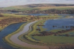
The thematic papers with the indication of the biotopes, in paper format, has been digitized in ARC/INFO using digitizers. Also the data already available in digital format have been converted into ARC/INFO format. The photos and slides have been digitized with a scanner. Altogether more than 2300 biotopes and beyond 1000 among photos and slides of the more meaningful biotopes, distributed on the whole national territory, have been collected.
Editing and normalization of the data
In this phase the errors of collection or generated during the format conversions have been eliminated. The conversion of data in vector format from their different origin, that often must be effected passing for intermediate formats, could cause different kinds of problems. The normalization of the data becomes a hard-working operation and has a great importance for the significance of the whole information system. The main operations of control and ratification effected have been:
- correction of imperfections due to collection errors;
- correction of the errors deriving from the format conversions;
- association of a univocal code for each biotopes;
- data entry of the alphanumeric database associated to the biotopes.
Elaboration of the data
The elaboration of the data has allowed to structure the database in a compatible format to the system of consultation prepared by the ENEA. In this phase, during which both geographical and alphanumeric databases have been organized in an unique Geographic Information System, the following operations have been carried out:
- geocoding of the biotopes in the UTM reference system;
- association with the biotopes of the alphanumeric information;
- cut of the IGM digital cartography as to the perimeter of the biotopes, through automated procedures in AML environment of ARC/ INFO. The method has allowed, starting from the cartography in raster format at different scales, to get automatically an informative layer in background to each biotope.
The automated procedure allows to:
a) automatically identify the raster data available for the area of interest, and, in case different data are available at different scales, to select the one at higher scale;
b) "cut" the IGM cartography following the limits of the biotope, in order to get an informative layer coherent with the vector data. This procedure, automatic in ARC/ INFO, has allowed notable time saving for an operation otherwise very onerous.
- representation of the sites in thematic maps on the basis of their classification (SNI, Sites of National Interest; SRI, Sites of Regional Interest; SCI, Sites of Community Interest; ZSP, Zones of Special Protection) or restitution in digital format, on CD-ROM support, of the whole database divided into regions.