
[Friday, 14 October 2016] Automated Processing chains with Spatial Modeler in ERDAS IMAGINE 2016.
Webinar: Automated Processing chains with Spatial Modeler in ERDAS IMAGINE 2016
Friday 14 October 2016
How to solve problems of rapid extraction of information from geospatial Big Data?
In about 45 minutes, this webinar gives participants the opportunity to learn step by step the procedure to create automated workflows to process satellite data. During the webinar the participants will receive all resources and tutorials, prepared in Italian language by Planetek Italia experts.
Webinar topics:
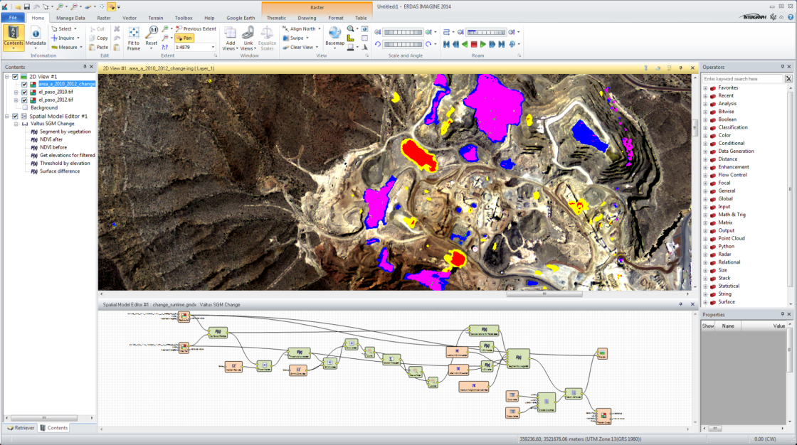
- Overview of the ERDAS IMAGINE Spatial Modeler;
- List and typologies of operators available;
- Graphic modeling and processing set-up;
- Spatial Modeler e Python;
- Examples of spatial models for the automated processing of data;
- Examples of processing with Sentinel-2 and Landsat-8 data;
- Preview and analysis of outputs;
- How to save a model, export of crypted models;
- Q&A;
- Conclusions.
 Watch the registration on Youtube (the webinar is in Italian language)
[video:https://youtu.be/oBUFW4DHg5M autoplay:0 width:560 height:315]
Description
Over the last few years the amount of information and data offered by Earth observation systems is progressively growing. They have increased over time both the spatial resolution and time resolution with which the data are made available to users. Today, in fact, we talk about big data from satellites, in reference to the large amount of data that could be used for the extraction of useful information.
 To let these data unleash their full value, it is necessary to find new technological solutions to extract the information in a short time by means of automated processes for data processing. Professionals who manage and process geospatial data with traditional methods is often forced to take a long time for repetitive tasks (data download, processing across multiple softwares, etc.), taking time away to higher-value activities, such as analysis of the results, critical to the adoption of decisions.
The solution to this problem consists of creating automated workflows, which ensure standardized and repeatable results. ERDAS IMAGINE Spatial Modeler can model geoprocessing operations, even complex, through customized and repeatable procedures, allowing the user to build custom workflows for image processing.
The webinar will show how to use the Spatial Modeler to: process Sentinel-2 data and Landsat 8; include Python scripts within the created models; manage the different data formats; include in the analysis vector data (shapefiles) and raster, and even more.
The webinar, organized in Italian language by Planetek Italia.
ERDAS IMAGINE is a powerful software suite of Hexagon Geospatial, which provides professional tools to quickly and easily manage satellite imagery, and allows the exploitation of information derived from open satellite data, simplifying operations, such as, classification, orthorectification, mosaicing, reprojection, photointerpretation, change detection ecc.
GeoXperience Webinars Agenda
Watch the agenda and subscribe to next webinars on https://www.planetek.it/geoxperience_webinar.
Note that, if you have missed some webinar, you can always replay it.