Sustainability of urban green spaces in Palermo

Sustainability of urban green spaces in Palermo


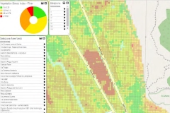
Improving the efficiency and sustainability of maintaining and watering Palermo’s public green areas, safeguarding and improving the general conditions of the city’s historic gardens, managing urban parks and mitigating the risks of fires in these areas.


The availability of public green space is an important indicator of quality of life in cities. Providing green areas and public gardens and ensuring the necessary maintenance, however, is costly for municipal coffers. The effects of climate change, the presence in some areas of phenomena such as drought, as well as the no longer avoidable need to manage water resources in a sustainable way, constitute a further challenge.

In order to manage, maintain and safeguard these areas efficiently and sustainably, it is important to have monitoring and analysis tools to guide decisions.

Sispi S.p.A. is a company owned by the Municipality of Palermo aiming at designing, implementing and managing the Sistema Informatico e Telematico Comunale (SITEC) (Municipal Information and Telematic System), and today supporting Palermo’s strategic vision (Palermo Digital Agenda) of addressing technological innovation in infrastructure and services and improving the quality of life of its more than 1.2 million residents.

SISPI needed a solution to improve the efficiency and sustainability of maintaining and watering Palermo’s public green areas, safeguarding and improving the general conditions of the city’s historic gardens, managing urban parks and mitigating the risks of fires in these areas.

It turned to Planetek Italia, which developed the Urban Green Spaces Monitoring Tool built on Hexagon’s M.App Enterprise technology.

SISPI needed a solution that would meet three objectives: significantly improve the overall health of green areas, optimize irrigation operations in green areas
and better manage vegetative stress caused by drought.

To meet these goals, Planetek developed the Urban Green Spaces Monitoring Tool, built with Hexagon’s M.App Enterprise, a unified geospatial enterprise platform that
allows users to create geospatial applications that enable them to monitor real-world changes, evaluate their impacts and act on the results.

The tool works by directly accessing open satellite data from Copernicus, the Earth observation component of the European Union’s space programme. Green areas with a
surface area greater than 1.5 hectares (e.g., parks, reserves and urban greenery) were analyzed, as well as gardens and private buildings occasionally accessible to the public.

This analysis allowed Planetek to calculate a synthetic index, called the Vegetation Stress Index, which provides an immediate indication of vegetative stress.
The index was calculated by multitemporal analysis of satellite data from the Copernicus Sentinel-2 constellation, by comparing the value of three multispectral indices (SAVI, LAI and NDVI). The analysis is repeated periodically using Hexagon’s Spatial Modeler technology, allowing SISPI to process the satellite data. The results are visualized through a dashboard built using M.App Enterprise.

With the Urban Green Spaces Monitoring Tool, Palermo can monitor, maintain and manage its green spaces more easily. The data provided by the Vegetation Stress Index
provides a better understanding of the health of these spaces because it reveals areas of vegetative stress. This means the city can closely monitor irrigation needs, especially during drought conditions, and keep its green spaces healthier.

In the future, SISPI plans to possibly add in higher resolution commercial data, detailed maps down to the vegetation species level and sensor data from irrigation systems.

Learn more and download the article