
A Feasibility Study

The MASMOV project funded by the European Space Agency (ESA/ESRIN) is a feasibility study on the applicability of Remote Sensing techniques in operational Landslide Risk Monitoring services.
The objective of this feasibility study is:
- Inventory and characterisation of Landslide types over the whole Italian territory and identification of all factors conditioning or triggering mass movement.
- Survey and critical analysis (on both technical and financial aspects) of current monitoring techniques used by the Civil Protection Authorities or any delegated body to monitor Slope Instabilities.
Review (i.e. advantages and limitations) and qualitative trade-off analysis of RS based technologies for landslide risk monitoring, including the possibility to integrate RS data from several satellite sensors for a deeper analysis of Slope Instability and the possibility to integrate data acquired by ground instrumentation (e.g. ground surveys).
Identification and demonstration of different image processing methodologies to cope with different types of landslide, the differences being essentially represented by the dimension of the area of interest, the slope inclination, the type of landslide movement and the vegetation cover.
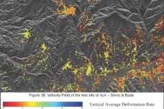
Utilisation of the most suitable Remote Sensing data processing algorithms over three Test Cases in Italy with landslide types representative of the Italian context (different lithology, different triggering factors, different dimension, etc.).

The MASMOV project has been issued as an activity of the the Data User Programme (DUP) that is a an optional programme of the European Space Agency(ESA), which aims at supporting Industry, Research Laboratories, User Communities and Governmental decision makers to bridge the gap that exists between research at the level of pilot projects and the operational and sustainable service provision of Earth Observation products at information level.---