
The urban monitoring with high resolution remote sensing data
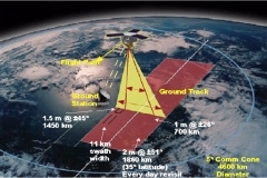
The monitoring of urban centers using remote sensing requires high resolution data, at least of the same order of the urban structures as buildings, street and green areas. For this reason, the availability of high resolution sensors, opens the way to new applications satisfying the requirements of urban planners and technical offices.

These satellites are of great support for a wide range of urban applications like land use, structure recognition, cartographic update, changes monitoring and others.
Planetek Italia is involved in many activities regarding the use of Very High Resolution satellites data in urban context.
The INPUT project (Innovazione dei Processi Urbanistici mediante Telerilevamento satellitare) is co-funded by ASI (Italian Space Agency) and is produced by a team of experts as two technological parks, Tecnopolis (Bari) and Technapoli (Napoli) and two value-added companies, Planetek Italia and Corista.
Main objective of the INPUT project is the remote sensing based technologies transfer to public administrations.
The local administration individuated by Planetek Italia and Tecnopolis is the Municipality of Bari and the problem on which the project has been focused is the monitoring of abusive buildings.
A first result of the presented activities is the introduction of remote sensing methodologies about the public administrations stimulating their interest trough the implementation of GIS example products showing remote sensing potentiality and advantages respect to traditional methodologies.
A further consideration regards the increasing diffusion of GIS in public administrations, since it is possible to realize GIS products, based on remote sensing data and not, integrating the normal procedures and easy to use also without remote sensing competencies.
In conclusion, the diffusion of a new generation of high resolution sensors will increase the use in urban context where very precise data are needed.