
Image and Corine Land Cover 2000

The Image and Corine Land Cover 2000 project, a joint initiative of EU Commission and EU Environment Agency, involves 26 countries in updating at year 2000 environmental parameters and information. The CORINE Land Cover is a full available database now including orthorectified Landsat 7 ETM satellite images of the italian and european territory, Land Cover and Changes definition maps.
The Italian National Authority managing the project and the diffusion of the products is APAT (Agency for Environmental Protection and Technical Services).

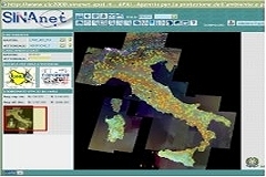
Planetek Italia has developed the system for the consultation and download of maps.
The products of I&CLC2000:
- · Ortho-rectified images + working units
- · National IMAGE2000 Mosaic
- a) national CLC2000
- b) Revised National CLC90 (optional)
- · National CLC Changes
- · European IMAGE2000 Mosaic
- a) European CLC2000
- b) Revised European CLC90s
- · European CLC Changes
- · CLC 250 m raster
- · CLC 100 m raster
- · CLC 1 km2 statistics
- · National Metadata
- · European Metadata