
European Coastal Zone thematic mapping for the Copernicus Land Monitoring Service
The European Environment Agency (EEA) plays a key role in the development of the Copernicus services, in particular in the technical coordination of the Copernicus Land Monitoring Service (CLMS) and the In Situ Component. Coastal Zone hotspot thematic mapping provides detailed information on Land Cover (LC) and Land Use (LU) classes to address environmental challenges and issues. In close cooperation with Copernicus Marine Environment Monitoring Service (CMEMS), CLMS is now working on a comprehensive coastal zone monitoring solution that is capable of addressing the complex and dynamic situations found in coastal environments.
Project updates
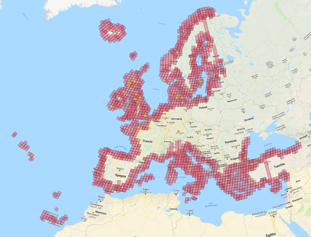
The European Environmental Agency announces the final release of the Coastal Zones hotspot thematic product for reference years 2012 and 2018 and accompanying change mapping are now available.
VISIT the Copernicus Land website to read more and start using CMLS data
The project
The European Environment Agency has awarded a 3 million contract to Planetek Italia for the first Copernicus Land - VHR Coastal Zone hotspot thematic mapping product on European Coastal Zones.
An industrial consortium of European Earth Observation (EO) service providers led by Planetek Italia will work for the European Environment Agency (EEA) to implement the new product on Coastal Zones that will enrich the Thematic Hotspot Mapping category of the COPERNICUS Land Monitoring Service (CLMS).
Thematic hotspot mapping activities within the CLMS aim, complementary to generic wall-to-wall mapping, to provide specific and detailed land cover / land use (LC/LU) information to address environmental challenges and issues.
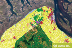
The new products will cover all European coastal territory to an inland depth of 10 km with a total area of approximately 730,000 km². The products will have a minimum mapping unit of 0.5 ha and record around 60 LC/LU classes.
 The initial production of the Coastal Zone hotspot thematic mapping will consist of:
a LC/LU status layer for 2012
a LC/LU change layer between 2012 and 2018
and a LC/LU status layer for 2018
As with the other thematic hotspot products, the Coastal Zones product will provide change/status every 6 years. The release of the Coastal Zones products is expected to begin by the end of 2020.
Due to the complexity of interests, directives and natural dynamics in the coastal zones, the EEA has planned the present activity to be implemented by the contractor in close contact with the national stakeholders over the entire project duration. An online platform will provide national stakeholders the opportunity to participate in preliminary surveys and contribute with their feedback in the preparatory activities.
Furthermore, national stakeholders will be involved to actively contribute to Copernicus user forums and EU Commission in the development and growth of Copernicus Land Coastal zones monitoring products and services.
The industrial consortium headed by Planetek Italia (Italy), is made up of three other European EO service providers with vast experience and knowledge on the Copernicus programme, namely GeoVille GmbH (Austria), Telespazio Ibérica (Spain) and Planetek Hellas (Greece).
Coastal Zone hotspot thematic mapping factsheet (PDF) and web dataset + library