
This webinar is one of a series of events lauched by DigitalGlobe which aims at giving a glance at the best worldwide case histories using satellite data.
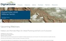
Wednesday 25th september has been held the webinar “Indexes and Thematic Maps for Urban Planning and Soil Loss Evaluation”. During the event Claudio La Mantia, Planetek Italia, presented the use of E.O. based indexes and maps developed for Urban Planning and Soil Loss Evaluation.
About the webinar
More and more urban planning processes need updated knowledge regarding the current situation of the areas, tools that can support planning processes and also systems to monitor the impact of the plans on the area.
All the planning stages (from the determination of the current situation, to the definition of the index that will be used to assess the Strategic Environmental Assessment (SEA), up to the creation of communication channels with the most important stakeholders) can be put in just one continuous planning process, that starts with the planning process and lasts throughout the validity of the plan.
Planetek Italia has developed standardized geospatial products, based on remotely sensed data, such as Worldview-2 data, designed in particular to support the planning process and currently used by several local authorities in Italy.
Timeline
- 2025
- 2024
- 2023
- 2022
- 2021
- 2020
- 2019
- 2018
- 2017
- 2016
- 2015
- 2014
- 2013
- 2012
- 2011
- 2010