
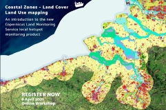
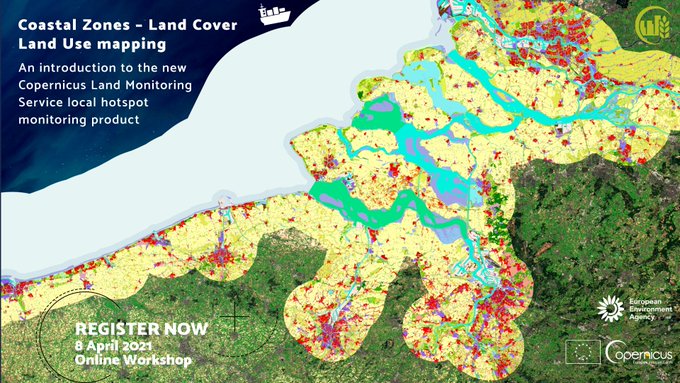
WORKSHOP: Copernicus CLMS Coastal Zones presentation - 8 April 2021
The European Environmental Agency has announced the release of the new Copernicus Land (CLMS) Coastal Zone hotspot thematic product for reference years 2012 and 2018 and accompanying change mapping.
The new products Coastal Zones product covers all European coastal territory (of 32 EEA Member States) to a landward distance of 10 km with a total area of approximately 730,000 km².
 WORKSHOP: CLMS Coastal Zones presentation - 8 April 2021 (10:00–15:40 CET)
The Copernicus Land Monitoring Service (CLMS) is hosting an online workshop on 8 April (10:00–15:40) to officially present its new Coastal Zone product, which enables thematic hotspot monitoring and mapping, and is designed to address the complex dynamics of coastal environment.
About CLMS Coastal Zones
Planetek Italia will join the workshop as coordinator of the consortium awarded of the mapping activity, which was done in close cooperation with EEA and with the active involvement of the European coastal communities. The consortium coordinated by Planetek Italia includes GeoVille GmbH (Austria), Telespazio Ibérica (Spain) and Planetek Hellas (Greece). The overall goals was to support Copernicus Land Monitoring Service (CLMS) and Copernicus Marine Environment Monitoring Service (CMEMS) on their comprehensive coastal zone monitoring solution that is capable of addressing the complex and dynamic situations found in coastal environments.
Learn more about the CLMS and CMEMS Coastal Zones monitoring service
To learn more about the Copernicus Land service, to explore the datasets together with the nomenclature and mapping guidelines for in-depth information, please visit https://land.copernicus.eu/local/coastal-zones
Learn more: