
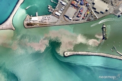
monitoring of water quality during dredging activities for the installation of new off-shore infrastructures
monitoring of water quality during dredging activities for the installation of new off-shore infrastructures