

On 28 September 2018, a 7.5 magnitude earthquake, follwed by a tsunami hit the island of Sulawesi, Indonesia. The natural disaster killed over 2,000 lives, left 100,000 people in need of emergency assistance, destroyed buildings, infrastructures, and farmland in several districts.
A joint program of ESA and Asian Development Bank called EO4SD is ongoing to help the Indonesian government develop a master plan for recovery and reconstruction. In this framework, Indra and Planetek Italia contributed to the implementation of this plan with Earth observation-based services.
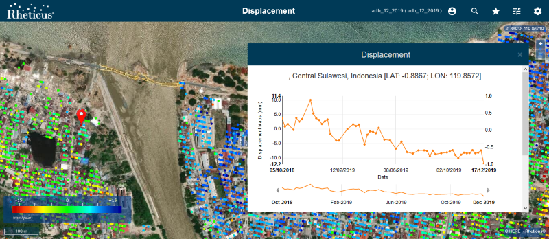 The information provided was terrain deformation mapping (before and after the earthquake) and reconstruction monitoring for the characterisation of the movements of the wide areas and of each single building, based on the PSI ground motion map, and to retrieve reconstruction and rehabilitation statistics based on the interpretation of the VHR satellite images.
Planetek's Rheticus platform, was the business intelligence visualisation tools used to process and deliver ground motion and building motion maps and geonalytics.
This enabled Indonesian Authorities to watch over the reconstruction and keep under control and mitigate the risks related to the instability of reconstruction areas, which still have to settle after the earthquake and the subsequent tsunami.
Read the article published by GeoConnexion and Download the Full article in PDF