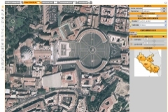
WebGIS systems enable to publish cartography on the Web, thus making valuable the investments for the realization of a Geographic Information System. Thanks to the intranet/internet connection, in fact, webGIS helps making information available in any moment and wherever to all organization's network members and community.
Powerful technologies available today make the information sharing easier and wider through "open standard" formats, overcoming technical boundaries to access data. It is a fact that many organizations is still using spatial analysis applications which work with different hardware and software environments. And to upgrade or to change this environment, very often is not a simple decision to make. A web oriented application sometimes can help overcoming problems such as installing the same application on the different client PCs, decreasing the quantity of data that circulates on the Internet.
This approach allows a centralized management of the application, the protection of data, the visibility and the access from the outside of the organization and also, thanks to mobile technologies and wireless communication technologies, the direct use by final users, who directly makes reliefs on the field, in order to increase their communication and productivity.
Planetek Italia designs and develops WebGIS systems and Spatial Data Infrastructures, based on proprietary and open standard formats, enabling thus the information sharing and the interoperability of databases. The solutions offered are tailored on users and administrators needs.