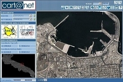
A simple tool designed to create and manage geoportals in accordance to the INSPIRE directive.
Planetek has a long and extensive experience in the creation and customization of Geoportals, to help clients keep content up to date and to simplify the communication with users and stakeholders. Cart@net provides a powerful workflow to support the content management, and all contents can be geo-located. The layout is consistent with the Web portal that hosts the Geoportal: it ensures both the continuity in the aesthetic appearance and the full functionalities of the service offered.
Cart@net exposes the services foreseen by INSPIRE (Discovery, View, Download and Transformation Services). Users can easily access the Geoportal content and interact with an organization through the Forum, the News area, the multimedia Calendar and the integration with social networks like Facebook and Twitter. All spatial data are accompanied by their own license thanks to the content management interface of the Geoportal that helps, while publishing the data, to choose and easily produce the appropriate license to be associated with each dataset.
Download the Cart@net brochure (PDF)
Cart@net is a web application developed by Planetek Italia and is a registered brand at Ufficio Italiano Brevetti e Marchi di Roma (29/07/2002)
Brochure
Download the brochure with an overview on its versions, features and characteristics.
White Paper
The full technical document
Licence agreement of Cart@net
View demonstration sites
- The Geoportal of Regione Abruzzo, Italy
- The ISPRA SINAnet Multiserver WebGIS The WebGIS application for the Italian ISPRA (Environmental Protection Agency) that allows to browse data from different agencies and different servers in Italy, based on both different IMS technologies(ESRI, Hexagon/Intergraph, UNM Mapserver) and exchange protocols.
- Geographic Information System of Regione Lazio Cartography On-Line by the Regional Direction for Land and Urban management - Territorial Department of Regione Lazio, where Rome is located
- Municipality of Venice, Italy
-
Province of Vicenza, Italy
The geoportal of Vicenza Province, Italy
-
Province of Foggia, Italy
The Geographic Information System of Foggia Province on-line with the thematic maps of the "PTCP", Territorial Planning of Coordination for the Province
- Regione Lombardia (AWARDED at ASITA 2009) The geoportal with all the cartography from the Geographic Information System of the Lombardia Region, where Milan is located, had its first online publishing activities with Cart@net.
- The Tourist WebPortal of Regione Puglia: (BIT2009 AWARD: Best Italian Tourist Portal) the official and most comprehensive tourist guide of Apulia. The cartographic navigation section has been developed by Planetek Italia. A number of useful tools are available such as the routing tool, the POI download for TOMTOM and other navigation systems, bookmarks, a geoblog, a 3D view, and more.
- Atlante Italiano: maybe the first and most comprehensive Italian Geoportal ever published, owned by the Italian Ministry of the Environment, was developed at early year 2000 with Cart@net. It published the cartography of the whole Italian territory on the Web Color airphotos of Italy and geocoded maps of the Reference Geographic System.
- Savona CartOnLine The portal provides the thematic maps of Savona Province. The system has been realized using the cartographic data served by the open source MapServer