


Nowadays geospatial knowledge can help cities make better decisions and become greener, as well as engage with citizens in democratic activities and in decision-making processes in order to preserve citizens and environment safety.
Through the use of satellite imagery, sensors, cameras, citizens interactions, and using geospatial intelligence we enable operators of the municipality and the police to get a quick acknowledge of the phenomena related to their areas, to process information, and to identify priority. All this in a very short time, enabling quick actions and effective interventions.
The solution adopted for the Municipality of Canosa di Puglia is based on Hexagon Geospatial Intelligence software, base maps, Earth observation data collected on a regular basis and external information sources (such as, for example, the Information System for the Environmental Protection of the Italian Police).
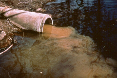
Users can create and maintain digital geo-located dossiers related to environmental crimes.
The purpose of the SIMP Canosa project is to provide an integrated service, for the monitoring and prevention of urban and environmental crimes, allowing the analysis and the control of the urbanization and the impact of other human activities in the urban and extraurban area.